")
IMAGE
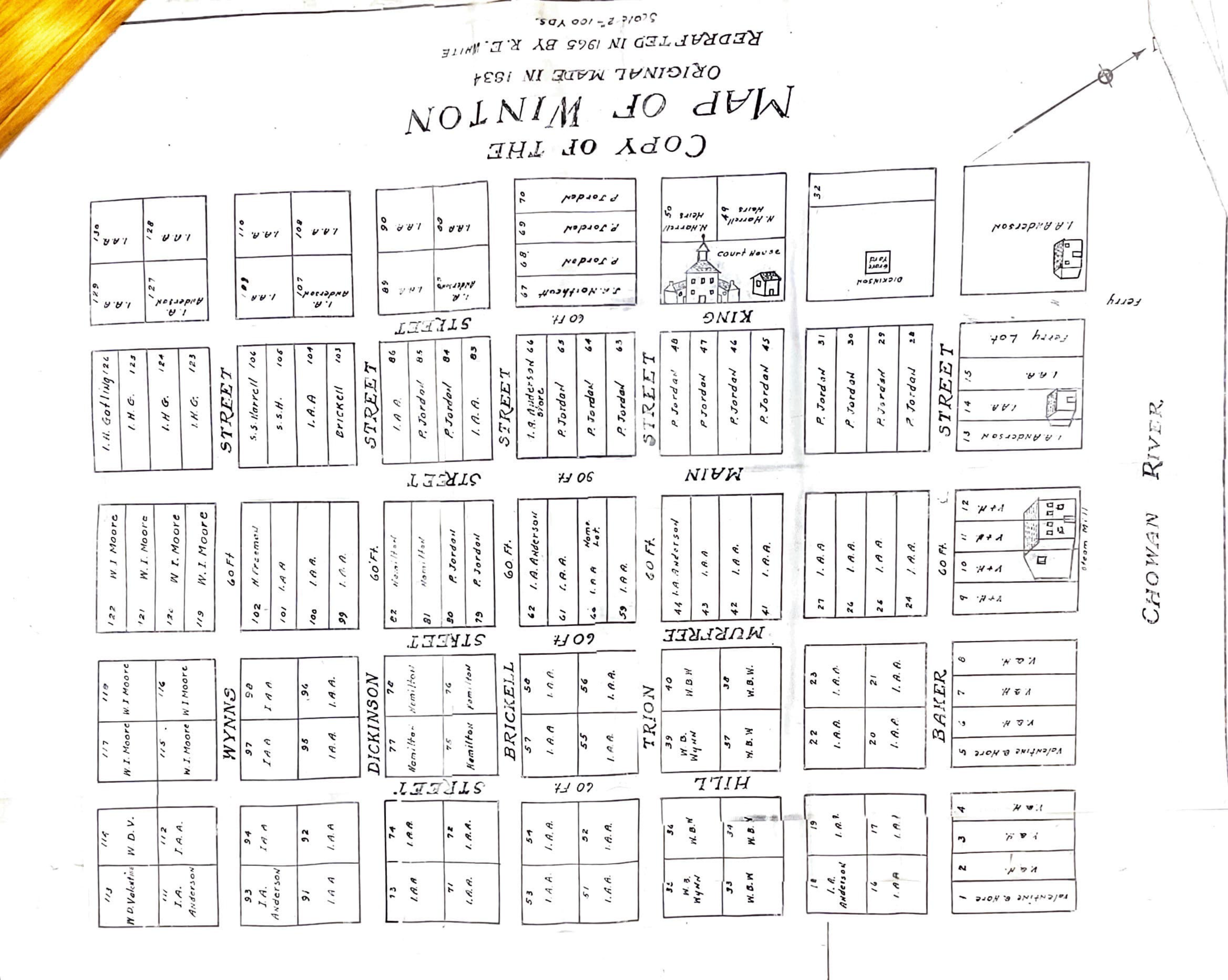
1834 Map of Winton Item Info
Source
- Preferred Citation:
- "1834 Map of Winton", From Plantation to Prison, Center for Digital Inquiry and Learning (CDIL)
- Reference Link:
- https://amalkir.github.io/VannPlantationArchive/items/m_3.html
Rights
- Rights:
- In Copyright – Rights Holder Unlocatable or Unidentifiable
- Standardized Rights:
- Copyright is retained by the authors of these materials, or their descendants, as stipulated by United States copyright law (Title 17 US Code). Individual researchers are responsible for using these materials in conformance with copyright law as well as any donor restrictions accompanying the materials.