")
IMAGE
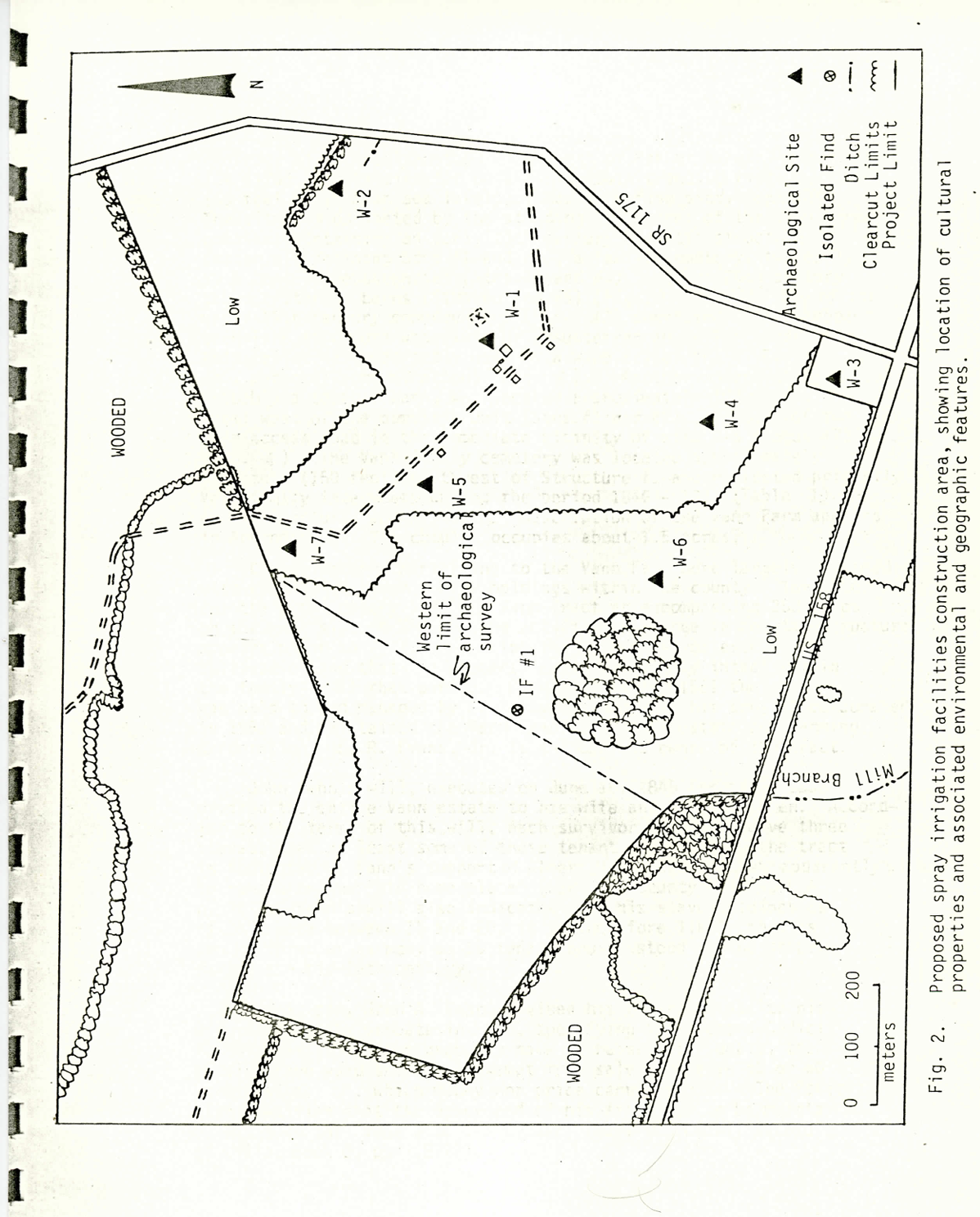
Map of the Vann Farmstead in 1981 Item Info
- Title:
- Map of the Vann Farmstead in 1981
- Creator:
- Carolina Archeological Services
- Date Created:
- 1981
- Description:
- Map of the proposed spray irrigation facilities construction area at the Vann Farmstead. Part of the Carolina Archeological Services Cultural and Environmental Study of the Proposed Winton Spray Irrigation Facilty in 1981.
- Subjects:
- map plantation
- Location:
- Winton, Hertford County, North Carolina
- Source:
- Cultural and Environmental Study of the Proposed Winton 201 Spray Irrigation Facilities Project, Hertford County, North Carolina. Ronald W. Anthony, Andrew N. Ash. Resource Studies Series ,1. Columbia, SC: Carolina Archaeological Services. 1983 ( tDAR id: 198040) ; doi:10.6067/XCV800038F
- Type:
- Image
- Format:
- image/png
- Language:
- eng
Source
- Preferred Citation:
- "Map of the Vann Farmstead in 1981", From Plantation to Prison, Center for Digital Inquiry and Learning (CDIL)
- Reference Link:
- https://amalkir.github.io/VannPlantationArchive/items/m_9.html
Rights
- Rights:
- In Copyright – Rights Holder Unlocatable or Unidentifiable
- Standardized Rights:
- This work is believed to be in copyright. The rights holder has not been identified. It is made available here for research, teaching, and private study under fair use. Further use may require permission from the rights holder.